
Horizonview Technologies

Direct measurement. Scalable capture. Actionable insight.

A vertically integrated aerial data company — we own and operate our fixed-wing fleet, sensors, and processing end-to-end for infrastructure, energy, and corridor mapping across the United States.

OwnedFixed-wing fleet
RGB · Thermal · LiDARFull sensor stack
3 hubsCoast to coast
About Horizonview

A vertically integrated aerial data company.

We own and operate our aircraft, sensors, and processing workflows end-to-end. That control means we set the schedule, own the quality, and stand behind every deliverable — no brokers, no intermediaries, no hand-offs.

01

Owned Fleet

Fixed-wing aircraft operated directly — no brokers, no intermediaries.

02

Full Sensor Stack

RGB, thermal & LiDAR sensors configured per mission.

03

In-House Analytics

Processing, QA, and delivery managed by our own experts.

04

Insight™ Platform

AI + human analysis delivered through a purpose-built portal.

Why Horizonview

What makes us different

01 / 04

Direct Ownership, Total Control

The Value: Complete oversight of our fleet means absolute reliability and cost-efficiency for your project.

Instead of relying on third-party charter networks or external aircraft providers, we own and operate our entire fleet. This direct-ownership model gives us full control over scheduling, maintenance, and quality assurance. By managing the entire process in-house, we eliminate external markups and pass those direct savings and efficiencies straight to you.

  • Complete Accountability: Your project is handled entirely by our team using our own aircraft, ensuring consistent, high-quality results from start to finish.
  • Flexible Scheduling: Controlling our own assets means we can rapidly adapt to weather windows or shifting project timelines without outside delays.
  • Direct-to-Client Value: By managing our fleet directly, we keep our operations lean and our pricing highly competitive.
Aircraft Platforms

Our fleet

A versatile fleet of fixed-wing aircraft, each optimized for a specific mission profile — from rapid-deployment agility to large-scale, multi-sensor survey capability.
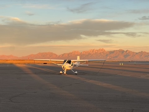
Horizonview's Remos GX on the ramp at sunset
Light Sport Platform

Remos GX

Agile, low-cost capture for targeted, repeat missions.
Cruise~90–110 kn
Endurance4–5 hrs
ProfileLow-altitude
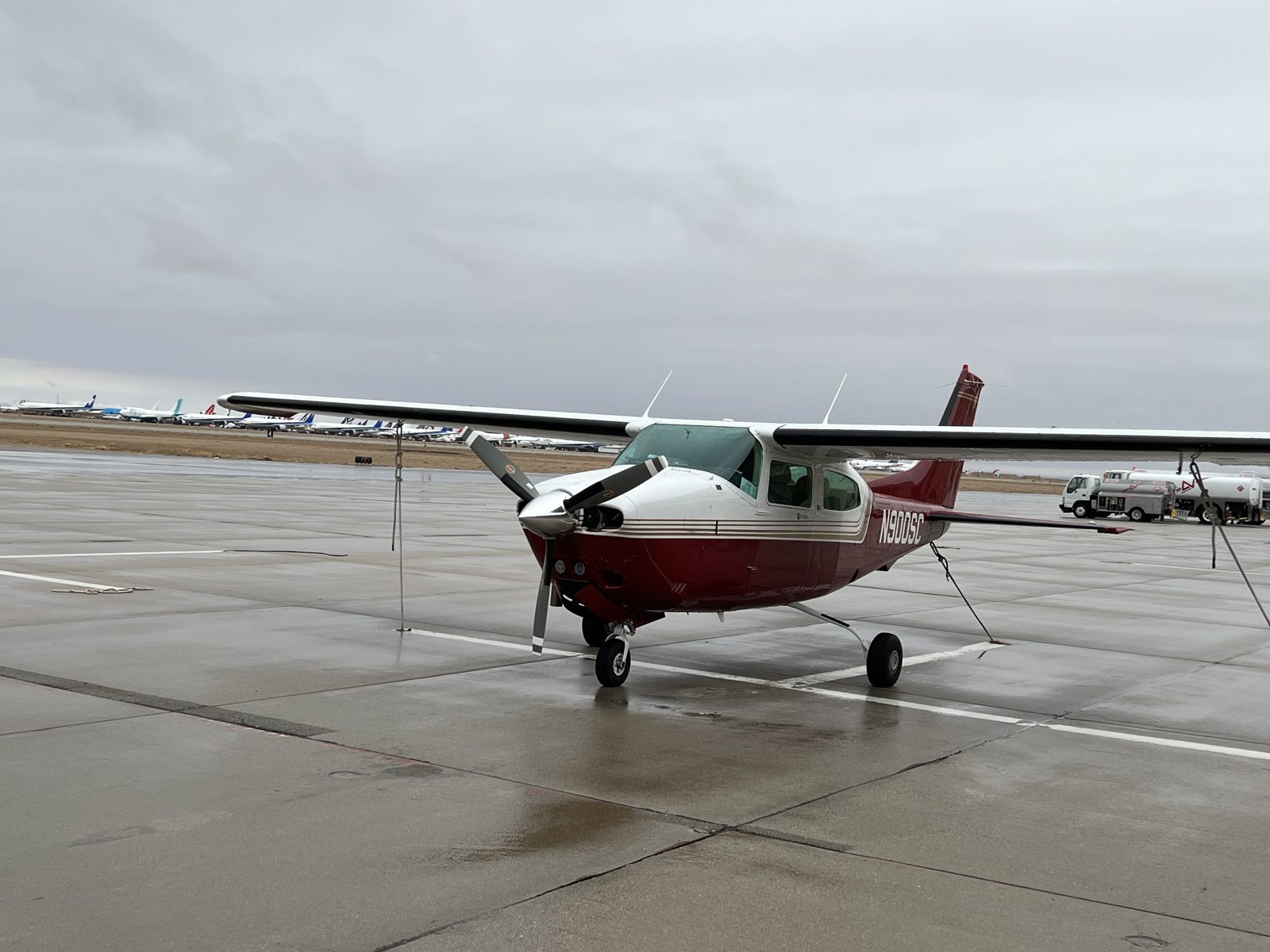
Horizonview's Cessna T210N on the ramp
Primary Survey Platform

Cessna T210N

The backbone of large-scale operations. Supports RGB + thermal simultaneously.
Cruise~140–160 kn
Endurance5–7+ hrs
ProfileHigh-altitude
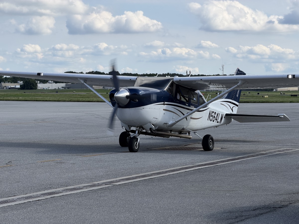
Horizonview's Cessna C206H Stationair on the ramp
LiDAR & Imaging Platform

Cessna C206H Stationair

Dedicated LiDAR & high-resolution imaging for wide-area and corridor surveys.

Cruise~135–145 kn
Endurance6–7 hrs
AvionicsG1000 / GFC700
Sensor Suite

Our sensor capabilities

A professional-grade sensor ecosystem across thermal, RGB, multispectral, and LiDAR — each selected for precision, reliability, and scalability.

RGB / Multispectral

Phase One iXM-RS150F · 50mm

  • 150 MP medium format
  • 1–2 cm GSD
  • Optional 4-band RGB + NIR
LWIR Thermal

Titan 1280 · 35mm

  • 1280 × 1024 radiometric
  • 7.5–14 µm spectral range
  • Wide-area thermal mapping
RGB

Sony ILX-LR1 · 85mm

  • 61 MP full-frame
  • 1.5–2 cm GSD
  • High detail, narrow FOV
LiDAR

RIEGL VQ-1560 II-S

  • 2.66M measurements/sec
  • 58° effective FOV
  • 2 cm precision · dual-channel
RGB

Canon 5DS R · 100mm

  • 50.6 MP full-frame
  • 2–3 cm GSD
  • Photogrammetry-optimized
Drone Platform

DJI Matrice 4T

  • Close-up inspection
  • Sub-centimeter detail
  • Rapid field deployment

Built for scale. Designed for precision.

0Mmeas / secRIEGL dual-channel LiDAR
0MPmax resolutionPhase One medium format
0mAGL ceilingWide-area survey altitude
0U.S. hubsCoast-to-coast mobilization
Data & Outputs

From raw capture to actionable intelligence

/ ORTHO

Orthomosaics

RGB & thermal — centimeter-level accuracy, distortion-free.

/ LIDAR

LiDAR products

Point clouds, DEM, DSM, contours & hydro-breaklines.

/ THERMAL

Thermal analytics

Defect detection by Level III thermographers.

/ INSIGHT

Insight™ Platform

AI + human analysis via portal or standard GIS formats.

Built for Scale · Designed for Precision

Whether it's one corridor or a national program — we deliver the data at the scale you require.

Energy

Large-scale inspection and thermal anomaly detection.

Corridors & Pipelines

Transmission lines, gas pipelines, and ROW mapping.

Multi-Site Programs

Cluster scanning reduces per-site cost and mobilization time.

Let's talk

Rapid quoting, flexible delivery, and scalable capacity for ongoing programs. Tell us about your site and we'll scope it.