Raw aerial imagery is only useful once it is processed. Horizonview turns IR and RGB captures into radiometric, georeferenced orthomosaics and defect maps in house, with no third-party stitching software or subscriptions required. You get clean, decision-ready data that works with the tools your team already uses.
What We Deliver
Radiometric Orthomosaics
Calibrated IR and high-resolution RGB orthomosaics, georeferenced and measurement-ready.
Defect and Anomaly Maps
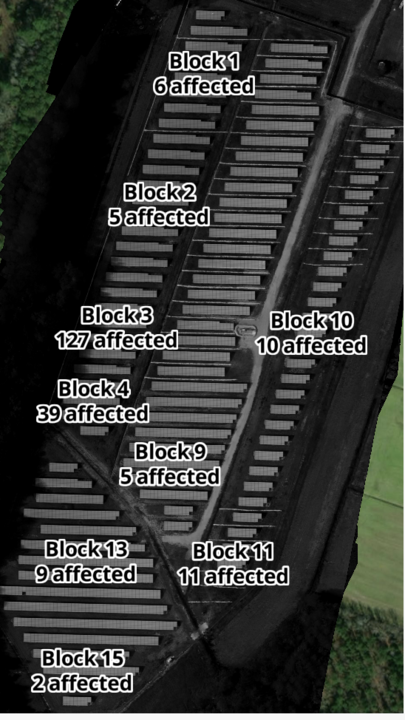
Automated detection of faults, hot spots, and anomalies, mapped to location.
Works With Your Tools
Exports that drop into GIS, CAD, and asset management without extra software.
Built Into the Insight Platform
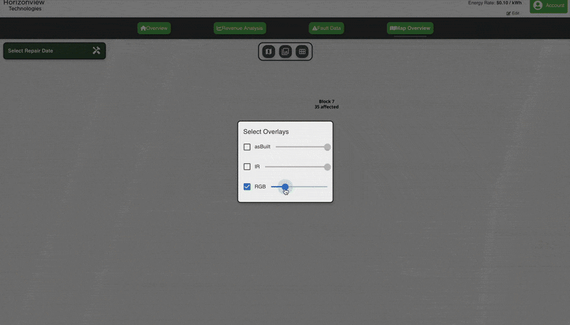
Every dataset is processed and delivered through the Insight platform, so your team can view, measure, and share results in one place. Faults, anomalies, and conditions are organized and exportable, ready to drop into your existing workflow.
Where It Fits
Solar: panel and string fault maps from IR and RGB.
Utilities and infrastructure: condition and anomaly mapping.
GIS and engineering: georeferenced orthomosaics and exports.
No stitching software or subscriptions required.
Processed in house for consistent quality and accountability.
Delivered through the Insight platform, organized and shareable.
From Sky to Insight™
We own the capture and the processing, so the imagery, orthomosaics, and analytics come from one accountable team, delivered through the Insight™ platform and ready to act on.