Aerial Data for Environmental & Floodplain Mapping
Survey-grade LiDAR elevation, floodplain and coastal mapping, and change detection for agencies, engineers, and environmental teams, captured from our own aircraft.
Environmental and floodplain work depends on accurate elevation and repeatable capture. We fly survey-grade LiDAR to produce bare-earth models, hydro-flattened surfaces, and canopy data, and we return on schedule to track change over time, all processed in house to rigorous federal and state specifications.
Deliverables
Elevation & Floodplain Models
Bare-earth DEMs, hydro-flattened surfaces, and contours for floodplain and drainage analysis.
Coastal & Vegetation
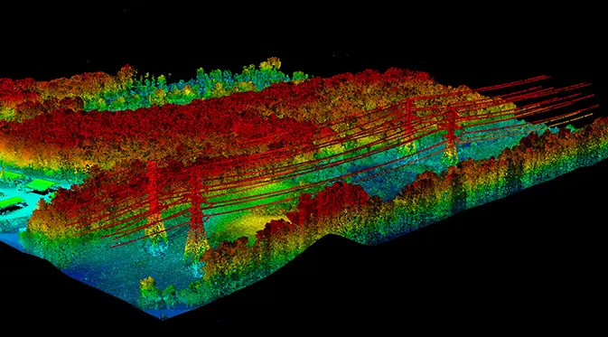
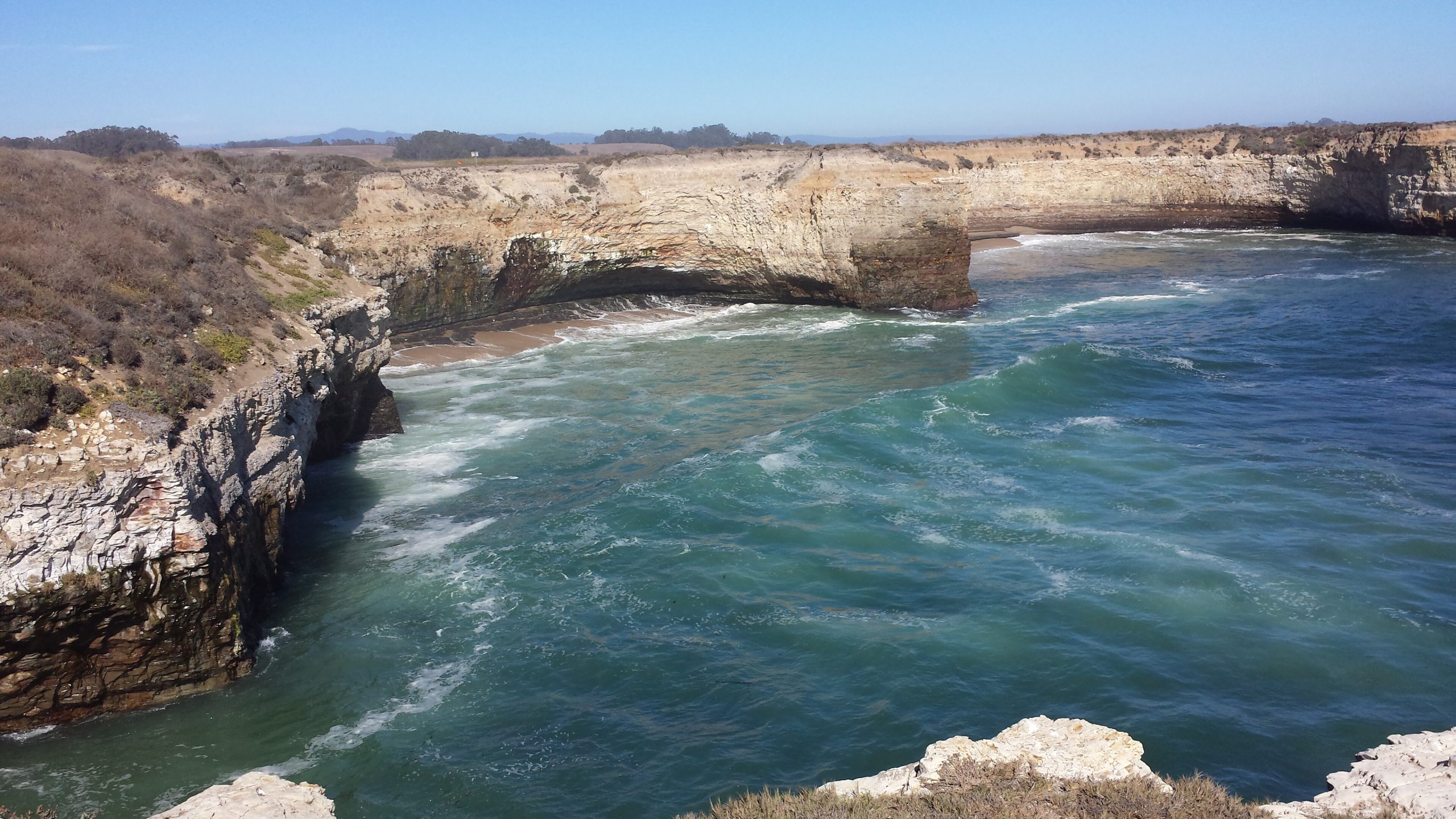
Coastal topography, canopy height, and vegetation structure from classified point clouds.
Change Detection
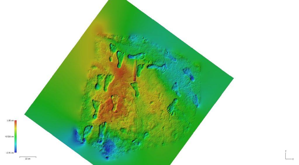
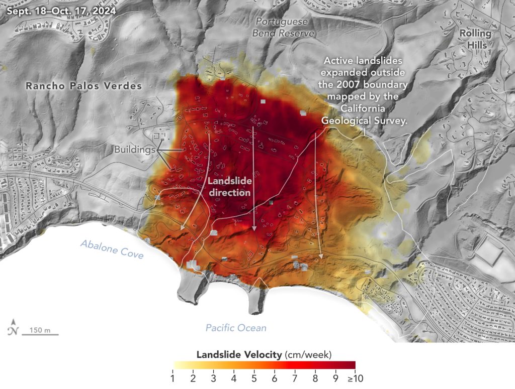
Repeatable capture aligned over time to measure erosion, growth, and ground movement.
Built on Vertical Integration
Owned aircraft and sensors plus in-house processing mean survey-grade, defensible data that meets federal and state specifications, delivered by one accountable team.
We own every step, from flight planning and sensor operation to in-house processing and final delivery. That vertical integration keeps quality consistent and puts accountability in one place.